
1 Pl. du Belvedere, 01710 Thoiry, France
1 Pl. du Belvedere, 01710 Thoiry, France
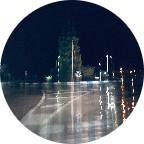
Part of the 'Route Forestiere (Forest road)' in the Pay-de-Gex in eastern France, from the Tiocan (starting point to the hike to the Reculet) to farges and back, at an altitude between 870 and 1170 m. Due to the forest trucks and the cold winters the road is in rather poor condition, but OK on a gravel bike. Enjoy!!
(PS: 'likes' and 'comments' on the video are much appreciated. Please send comments on the functioning of the app to the User Support)
For more than 1000 scenic videos all over Europe, see my other videos by Gonvil and Playlists by Gonvil.
 Segmentos Strava
Los fragmentos de este vídeo son segmentos Strava verdaderos


| Pos. | Usuario | Chrono | Date |
|---|---|---|---|
| 1 | 00:32:08 | 7/27/2021 | |
| 2 | 00:32:25 | 5/13/2021 | |
| 3 | 00:33:21 | 5/18/2021 | |
| 4 | 00:33:54 | 11/25/2020 | |
| 5 | 00:35:35 | 5/12/2021 |

Puedes probar nuestra aplicación completa y gratuitamente y desafiar a los miembros de la comunidad.
iOS Android ¿Ningún acceso a Google Play? Descargar el APK ahoraAccede a todas las funciones y vídeos por solo $11.99/ mensuales
Suscríbete ahoraProbablemente te gustará...

12.442 mi | 00:45:22

15.128 mi | 00:55:57

10.433 mi | 00:44:11

9.218 mi | 00:35:00

15.76 mi | 01:15:25

16.431 mi | 02:09:06

8.163 mi | 00:26:38

12.467 mi | 00:40:42

10.125 mi | 00:54:53

20.1 mi | 01:15:52

19.817 mi | 01:40:26

7.743 mi | 00:29:23


 Francés
 Español
 Alemán
 United States
 Chino
Chino
 Italian
 Dutch
Dutch