
71 Route du Col de Cou, 74550 Cervens, France
841 Route de la Vallée du Giffre, 74250 Fillinges, France
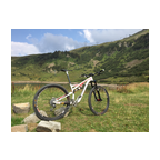
A nice sunny ride in the beautiful Chablais mountains/hills south of Thonon-les-Bains. The video starts at the 'Col de Cou' at about 1100 m altitude and finishes 550 m lower in the village Fillinges. The area is also called 'Vallee Verte (green valley)'. You will see why... Enjoy!!
(PS: 'likes' and 'comments' on the video are much appreciated. Please send comments on the functioning of the app to the User Support)
For more than 1000 scenic videos all over Europe, see my other videos by Gonvil and Playlists by Gonvil.
 Segmentos Strava
Los fragmentos de este vídeo son segmentos Strava verdaderos


| Pos. | Usuario | Chrono | Date |
|---|---|---|---|
| 1 | 00:23:13 | 5/7/2023 | |
| 2 | 00:23:23 | 2/19/2021 | |
| 3 | 00:24:42 | 7/13/2022 | |
| 4 | 00:25:37 | 2/26/2021 | |
| 5 | 00:26:43 | 6/21/2021 |

Puedes probar nuestra aplicación completa y gratuitamente y desafiar a los miembros de la comunidad.
iOS Android ¿Ningún acceso a Google Play? Descargar el APK ahoraAccede a todas las funciones y vídeos por solo $11.99/ mensuales
Suscríbete ahoraProbablemente te gustará...

15.59 mi | 01:12:32

12.442 mi | 00:45:22

7.89 mi | 00:44:33

16.861 mi | 01:08:52

11.534 mi | 00:42:52

12.388 mi | 00:50:31

10.63 mi | 00:37:46

12.428 mi | 00:40:43

17.566 mi | 00:44:31

7.147 mi | 00:29:44

15.128 mi | 00:55:57

15.403 mi | 00:52:52


 Francés
 Español
 Alemán
 United States
 Chino
Chino
 Italian
 Dutch
Dutch