
Unnamed Road,43-382, 43-382 Bielsko-Biała, Poland
Q252+5F Bielsko-Biala, Poland
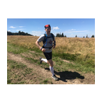
 Segments Strava
Des sections de cette vidéo sont des segments Strava.


| Pos. | Nom d'utilisateur | Chrono | Date |
|---|---|---|---|
| 1 | 00:21:21 | 2/25/2022 | |
| 2 | 00:22:08 | 4/29/2023 | |
| 3 | 00:29:29 | 3/2/2022 | |
| 4 | 00:29:31 | 3/1/2022 | |
| 5 | 00:30:21 | 1/22/2024 |

Vous pouvez tester notre application entièrement et gratuitement dès maintenant et défiez les autres membres de la communauté pendant 7 jours.
iOS Android Pas d'accès au Google Play ? Télécharger notre APKProfitez de toutes les fonctionnalités ainsi que de toutes les vidéos à partir de $11.99/mois
S'abonnerVous allez probablement aimer...

6.214 mi | 01:04:51

4.367 mi | 00:31:59

6.211 mi | 00:54:34

5.671 mi | 01:02:41

4.661 mi | 00:41:02

6.224 mi | 01:01:05

5.64 mi | 00:40:00

6.241 mi | 01:25:14

6.164 mi | 01:08:43

3.886 mi | 00:34:28

6.636 mi | 00:53:26

5.91 mi | 00:48:29


 Anglais
 Allemand
 United States
 Chinois
 Espagnol
 Italien
 Néerlandais