
12 Rue du Viaduc, 26150 Die, France
6010 Route du, 26420 Saint-Agnan-en-Vercors, France
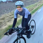
Maybe an unknown but very nice Col. A nice steady climb that never really gets steep. The Col de Rousset is located in Provence-Alpes-Cote d'Azur.
This climb is part of the Alps. From Die the Col de Rousset is 20.6 km long. Over this distance you bridge 858 altimeters. The average gradient of the climb is therefore 4.2 %.
You like this video? Check out my other video's and don't forget the like button or leave a comment for further suggestions.
 Segmenti di Strava
Porzioni di questo video sono effettivi segmenti di Strava


| Pos. | Nome utente | Chrono | Date |
|---|---|---|---|
| 1 | 00:29:55 | 11/14/2024 | |
| 2 | 00:31:13 | 1/22/2025 | |
| 3 | 00:34:18 | 7/20/2024 | |
| 4 | 00:36:25 | 7/17/2024 | |
| 5 | 00:37:28 | 12/25/2023 |

Puoi provare la nostra applicazione in modo completo e gratuito e sfidare i membri della community.
iOS Android Nessun accesso a Google Play? Scarica APK oraOttieni tutte le funzionalità e i video a soli $11.99/mese
Abbonati oraProbabilmente ti piacerà...

13.998 mi | 02:30:11

12.005 mi | 01:04:44

14.736 mi | 01:11:08

15.531 mi | 00:57:21

13.611 mi | 00:30:04

9.936 mi | 00:44:18

19.116 mi | 01:13:12

10.196 mi | 00:48:43

10.131 mi | 00:43:34

9.756 mi | 00:48:13

20.089 mi | 01:00:00

8.046 mi | 00:34:08


 Francese
 Inglese
 Tedesco
 United States
 Cinese
 Spanish
 Dutch
Dutch