
18 Rue des Communes de France, 06660 Saint-Étienne-de-Tinée, France
455 Rte de la Tinée, 06710 Tournefort, France
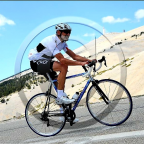
Don't miss this!!! The downhill (in 2 parts) on the highest paved road in France with spectacular views on the mountains. Perfect after a tough day for a relaxed workout while admiring the scenery. It is a very very long downhill, almost reaching Nice. Enjoy!!
For the first part see Bonette downhill - Part 1
See other downhills at downhills by Gonvil
(PS: 'likes' and 'comments' on the video are much appreciated. Please send comments on the functioning of the app to the User Support)
For more than 1000 scenic videos all over Europe, see my other videos by Gonvil and Playlists by Gonvil.
 Strava分段
此视频的部分是实际Strava段片


您可能会喜欢这个...

29.966 mi | 01:58:15

31.153 mi | 01:38:23

25.786 mi | 01:36:22

23.649 mi | 01:22:56
![[LONG] Kielce - Bolmin - Kielce (Poland)🚴🏘️🌲⛰️](https://dtn44hfc1xtr4.cloudfront.net/z/8/z8hrj6_320x240.jpg?Expires=1755146166&Signature=F9p9RXmo~WGM2d-E8DNtEDNGDflOLsMif41OlY-x8-EGUMzdXoOKdk7LXqyooKyRS~WiQ5M0pOTbbLjmK0~RvA~OY8TbMO2ZcmLxiyLpZiFHUTRdcL185XVOUnlLWqIQtT63bInY83mo3wfC2DTG4ViImAbnCmbDtMHUNilSjktE4xpNajfxpGWe1-OaOGZ~iBdx1sXGTVGI~4wFxVHy4bVzgMAmvwurvBOMuhkCjGOgiDNFcDE2E0jIi0v~wQLO0r0dvmTFqyCva0Umdf4P7uE7JXQPN046VuzsCgqqaNEwM84fbH7gjRic~puZ4f8J3LwhBYrwwGkshT5Ur-E7rA__&Key-Pair-Id=APKAIAOH4YUSYMI7SPBA)
38.334 mi | 02:03:29

34.666 mi | 03:05:19

17.566 mi | 00:44:31

15.76 mi | 01:15:25

16.735 mi | 01:14:18

16.431 mi | 02:09:06

18.721 mi | 00:58:56

20.626 mi | 01:22:39


 法语
法语
 英语
英语
 德语
德语
 美国
美国
 西班牙的
西班牙的
 意大利的
意大利的
 荷兰语
荷兰语