
Route des Barraques, Les Curtets, La Table, Chambéry, Savoy, Auvergne-Rhône-Alpes, Metropolitan France, 73110, France
Route du Col de Champ Laurent, Prémicon, Champ-Laurent, Chambéry, Savoy, Auvergne-Rhône-Alpes, Metropolitan France, 73390, France
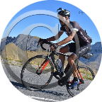
13,5km ; 805m* ; 5,98% ; 0h55m35s ; 14,57km/h *diff alt 1116-311 (Garmin Edge 530 GPX)
 Strava segments
Portions of this video are actual Strava segments


| Pos. | Username | Chrono | Date |
|---|---|---|---|
| 1 | 00:33:45 | 11/13/2023 | |
| 2 | 00:34:44 | 9/23/2024 | |
| 3 | 00:35:12 | 11/13/2023 | |
| 4 | 00:40:40 | 3/12/2024 | |
| 5 | 00:40:41 | 1/20/2024 |

You can try our application fully and for free and challenge community members.
iOS Android No access to Google Play? Download the APK nowGet all features and videos for only $11.99/month
Subscribe nowYou will probably like...

7.147 mi | 00:29:44

10.433 mi | 00:44:11

5.892 mi | 00:24:01

9.218 mi | 00:35:00

8.163 mi | 00:26:38

10.125 mi | 00:54:53

7.356 mi | 00:35:06

5.802 mi | 00:28:59

7.743 mi | 00:29:23

11.462 mi | 00:51:35

11.556 mi | 00:47:28

11.585 mi | 01:08:43


 French
 German
 United States
 Chinese
 Spanish
 Italian
 Dutch
Dutch