
71 Route du Col de Cou, 74550 Cervens, France
841 Route de la Vallée du Giffre, 74250 Fillinges, France
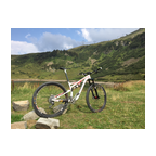
A nice sunny ride in the beautiful Chablais mountains/hills south of Thonon-les-Bains. The video starts at the 'Col de Cou' at about 1100 m altitude and finishes 550 m lower in the village Fillinges. The area is also called 'Vallee Verte (green valley)'. You will see why... Enjoy!!
(PS: 'likes' and 'comments' on the video are much appreciated. Please send comments on the functioning of the app to the User Support)
For more than 1000 scenic videos all over Europe, see my other videos by Gonvil and Playlists by Gonvil.
 Strava segments
Portions of this video are actual Strava segments


| Pos. | Username | Chrono | Date |
|---|---|---|---|
| 1 | 00:23:13 | 5/7/2023 | |
| 2 | 00:23:23 | 2/19/2021 | |
| 3 | 00:24:42 | 7/13/2022 | |
| 4 | 00:25:37 | 2/26/2021 | |
| 5 | 00:26:43 | 6/21/2021 |

You can try our application fully and for free and challenge community members.
iOS Android No access to Google Play? Download the APK nowGet all features and videos for only $11.99/month
Subscribe nowYou will probably like...

14.736 mi | 01:11:08

15.531 mi | 00:57:21

20.089 mi | 01:00:00

8.046 mi | 00:34:08

12.778 mi | 00:57:07

7.982 mi | 00:32:09

8.213 mi | 00:57:42

15.97 mi | 01:05:11

9.762 mi | 01:02:13

13.323 mi | 01:08:24

20.357 mi | 01:06:14

11.059 mi | 02:14:22


 French
 German
 United States
 Chinese
 Spanish
 Italian
 Dutch
Dutch