
967, Nad Żylicą, Pod Godziszką, Rybarzowice, gmina Buczkowice, Bielsko County, Silesian Voivodeship, 43-378, Poland
Podest widokowy na Skrzyczne, Doliny, Kurówki, Szczyrk, Bielsko County, Silesian Voivodeship, 43-370, Poland
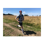
 Strava segments
Portions of this video are actual Strava segments


| Pos. | Username | Chrono | Date |
|---|---|---|---|
| 1 | 00:26:06 | 11/6/2023 | |
| 2 | 00:28:59 | 2/6/2024 | |
| 3 | 00:29:49 | 12/24/2024 | |
| 4 | 00:31:55 | 5/5/2025 | |
| 5 | 00:41:08 | 11/9/2024 |

You can try our application fully and for free and challenge community members.
iOS Android No access to Google Play? Download the APK nowGet all features and videos for only $11.99/month
Subscribe nowYou will probably like...

3.098 mi | 00:26:58

4.661 mi | 00:41:02

4.974 mi | 00:50:19

3.269 mi | 00:24:41

3.226 mi | 00:30:31

2.995 mi | 00:35:14

3.189 mi | 00:31:14

5.883 mi | 00:45:29

3.728 mi | 00:33:17

6.224 mi | 01:01:05

3.762 mi | 00:57:32

5.057 mi | 00:55:20


 French
 German
 United States
 Chinese
 Spanish
 Italian
 Dutch
Dutch