
8500 W Butte Rd, Live Oak, CA 95953, USA
2588 Acacia Ave, Sutter, CA 95982, USA
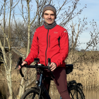
The Sutter Buttes lie 50 miles north of Sacramento, California, and are sometimes called the world’s smallest mountain range. However, the buttes are technically not mountains, but rather hills topped by eroded domes formed by volcanic activity 1.6 million years ago. Sutter Buttes’ highest point is 2,122 feet high, a dramatic contrast to the flat agricultural lands that stretch out past the buttes for miles. The Buttes, and the neighboring town, are named after Captain John Sutter, who received a large land grant from the Mexican government in the 19th century. Most of the land is private property used by ranchers and farmers, although in 2003 the state of California acquired 1,785 acres of the Buttes, including a section called Peace Valley. On April 8, 2005, the State Park and Recreation Commission classified the State Parks Sutter Buttes Property as a State Park.
Ride my other videos around the Sutter Buttes
Enjoy my other videos and playlists!
 Segmentos Strava
Ningún segmento Strava para este vídeo.
| Pos. | Usuario | Chrono | Date |
|---|---|---|---|
| 1 | 00:04:49 | 12/20/2020 | |
| 2 | 00:04:51 | 8/30/2020 | |
| 3 | 00:05:18 | 9/3/2020 | |
| 4 | 00:05:19 | 2/15/2021 | |
| 5 | 00:05:22 | 4/7/2021 |

Puedes probar nuestra aplicación completa y gratuitamente y desafiar a los miembros de la comunidad.
iOS Android ¿Ningún acceso a Google Play? Descargar el APK ahoraAccede a todas las funciones y vídeos por solo $11.99/ mensuales
Suscríbete ahoraProbablemente te gustará...
![[Short Slow Japan Sights]seki-jyuku 三重県 関宿](https://dtn44hfc1xtr4.cloudfront.net/6/k/6kpgz4_320x240.jpg?Expires=1716115672&Signature=gTxpfk1hQqd9gV0eFd08Jas4ovZGu2DpLCHYy-da2ogUQLI3qmeADYR33u0v05Xd2gqihZFWcoTbvofCBJOhaFnMxnY4gpBL42AjALI0Y7amTra-B6p5MtT-CvU1fukNs0EgtPvT3gqcVjWI~NjDDQLiX~doIeUPdrB9AdSLNSHSycJdusZVcFYCpwvTLaYRlEOO5KW8~5VefBlXFdg~DyzrDRRflQ82PshjcMfuinSwUxR1XQD9tDj4nkI9gQWi5~VU9ERtltpn2ev3KBzRAiRCX8sdwtxC2HXnsd-I0xVI-P4hBys3mbg8P6dloU2yFX5qqv6Xy~Hk5q9yjbtaYw__&Key-Pair-Id=APKAIAOH4YUSYMI7SPBA)
1.702 mi | 00:15:15

2.041 mi | 00:11:50

1.968 mi | 00:15:59

2.615 mi | 00:16:16

1.54 mi | 00:04:58

3.091 mi | 00:31:51

1.786 mi | 00:12:24

1.97 mi | 00:08:32

2.08 mi | 00:15:58

2.602 mi | 00:24:48

2.912 mi | 00:24:09

1.097 mi | 00:05:34


 Francés
 Español
 Alemán
 United States
 Chino
Chino
 Italian
 Dutch
Dutch