
Unnamed Road,43-382, 43-382 Bielsko-Biała, Poland
Q252+5F Bielsko-Biala, Poland
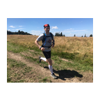
 Strava-segmenten
Delen van deze video zijn de eigenlijk Strava-segmenten


| Pos. | Gebruikersnaam | Chrono | Date |
|---|---|---|---|
| 1 | 00:21:21 | 2/25/2022 | |
| 2 | 00:22:08 | 4/29/2023 | |
| 3 | 00:29:29 | 3/2/2022 | |
| 4 | 00:29:31 | 3/1/2022 | |
| 5 | 00:30:21 | 1/22/2024 |

U kunt onze applicatie volledig en gratis proberen en leden van de gemeenschap uitdagen.
iOS Android Geen toegang tot Google Play? Download de .apk nuKrijg toegang tot alle functies en video’s voor maar $11.99/maand
Neem nu een abonnementU zult ..... waarschijnlijk leuk vinden

6.214 mi | 01:04:51

4.661 mi | 00:41:02

6.224 mi | 01:01:05

5.64 mi | 00:40:00

6.164 mi | 01:08:43

5.91 mi | 00:48:29

3.786 mi | 00:43:13

4.99 mi | 00:44:08

6.841 mi | 00:47:32

4.222 mi | 00:45:42

5.741 mi | 00:57:16

6.783 mi | 00:56:53


 Frans
Frans
 Engels
 Duits
Duits
 United States
 Chinees
 Spanish
 Italian