
71 Route du Col de Cou, 74550 Cervens, France
841 Route de la Vallée du Giffre, 74250 Fillinges, France
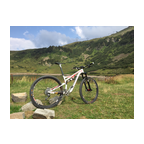
A nice sunny ride in the beautiful Chablais mountains/hills south of Thonon-les-Bains. The video starts at the 'Col de Cou' at about 1100 m altitude and finishes 550 m lower in the village Fillinges. The area is also called 'Vallee Verte (green valley)'. You will see why... Enjoy!!
(PS: 'likes' and 'comments' on the video are much appreciated. Please send comments on the functioning of the app to the User Support)
For more than 1000 scenic videos all over Europe, see my other videos by Gonvil and Playlists by Gonvil.
 Strava-segmenten
Delen van deze video zijn de eigenlijk Strava-segmenten


| Pos. | Gebruikersnaam | Chrono | Date |
|---|---|---|---|
| 1 | 00:23:13 | 5/7/2023 | |
| 2 | 00:23:23 | 2/19/2021 | |
| 3 | 00:24:42 | 7/13/2022 | |
| 4 | 00:25:37 | 2/26/2021 | |
| 5 | 00:26:43 | 6/21/2021 |

U kunt onze applicatie volledig en gratis proberen en leden van de gemeenschap uitdagen.
iOS Android Geen toegang tot Google Play? Download de .apk nuKrijg toegang tot alle functies en video’s voor maar $11.99/maand
Neem nu een abonnementU zult ..... waarschijnlijk leuk vinden

15.59 mi | 01:12:32

12.442 mi | 00:45:22

7.89 mi | 00:44:33

16.861 mi | 01:08:52

11.534 mi | 00:42:52

12.388 mi | 00:50:31

10.63 mi | 00:37:46

12.428 mi | 00:40:43

17.566 mi | 00:44:31

7.147 mi | 00:29:44

15.128 mi | 00:55:57

15.403 mi | 00:52:52


 Frans
Frans
 Engels
 Duits
Duits
 United States
 Chinees
 Spanish
 Italian