
3CGW+XC Macheta, Cundinamarca, Colombia
Cra. 7 #9-65, Guateque, Boyacá, Colombia
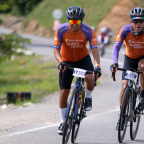
 Strava segments
Portions of this video are actual Strava segments


| Pos. | Username | Chrono | Date |
|---|---|---|---|
| 1 | 00:30:26 | 1/24/2025 | |
| 2 | 00:44:11 | 9/22/2022 | |
| 3 | 00:44:44 | 5/2/2025 | |
| 4 | 00:51:56 | 5/28/2025 |

You can try our application fully and for free and challenge community members.
iOS Android No access to Google Play? Download the APK nowGet all features and videos for only $11.99/month
Subscribe nowYou will probably like...

8.785 mi | 01:00:16

8.349 mi | 00:46:59

15.59 mi | 01:12:32

12.442 mi | 00:45:22

9.118 mi | 00:35:14

9.255 mi | 00:48:41

10.062 mi | 00:39:43

7.89 mi | 00:44:33

11.534 mi | 00:42:52

12.388 mi | 00:50:31

10.63 mi | 00:37:46

12.428 mi | 00:40:43


 French
 English
 German
 Chinese
 Spanish
 Italian
 Dutch
Dutch