
1 Pl. du Belvedere, 01710 Thoiry, France
1 Pl. du Belvedere, 01710 Thoiry, France
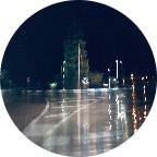
Part of the 'Route Forestiere (Forest road)' in the Pay-de-Gex in eastern France, from the Tiocan (starting point to the hike to the Reculet) to farges and back, at an altitude between 870 and 1170 m. Due to the forest trucks and the cold winters the road is in rather poor condition, but OK on a gravel bike. Enjoy!!
(PS: 'likes' and 'comments' on the video are much appreciated. Please send comments on the functioning of the app to the User Support)
For more than 1000 scenic videos all over Europe, see my other videos by Gonvil and Playlists by Gonvil.
 Strava segments
Portions of this video are actual Strava segments


| Pos. | Username | Chrono | Date |
|---|---|---|---|
| 1 | 00:32:08 | 7/27/2021 | |
| 2 | 00:32:25 | 5/13/2021 | |
| 3 | 00:33:21 | 5/18/2021 | |
| 4 | 00:33:54 | 11/25/2020 | |
| 5 | 00:35:35 | 5/12/2021 |

You can try our application fully and for free and challenge community members.
iOS Android No access to Google Play? Download the APK nowGet all features and videos for only $11.99/month
Subscribe nowYou will probably like...

8.785 mi | 01:00:16

8.349 mi | 00:46:59

15.59 mi | 01:12:32

12.442 mi | 00:45:22

9.118 mi | 00:35:14

9.255 mi | 00:48:41

10.062 mi | 00:39:43

7.89 mi | 00:44:33

11.534 mi | 00:42:52

12.388 mi | 00:50:31

10.63 mi | 00:37:46

12.428 mi | 00:40:43


 French
 German
 United States
 Chinese
 Spanish
 Italian
 Dutch
Dutch