
Unnamed Road,43-382, 43-382 Bielsko-Biała, Poland
Q252+5F Bielsko-Biala, Poland
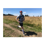
 Strava segments
Portions of this video are actual Strava segments


| Pos. | Username | Chrono | Date |
|---|---|---|---|
| 1 | 00:21:21 | 2/25/2022 | |
| 2 | 00:22:08 | 4/29/2023 | |
| 3 | 00:29:29 | 3/2/2022 | |
| 4 | 00:29:31 | 3/1/2022 | |
| 5 | 00:30:21 | 1/22/2024 |

You can try our application fully and for free and challenge community members.
iOS Android No access to Google Play? Download the APK nowGet all features and videos for only $11.99/month
Subscribe nowYou will probably like...

4.397 mi | 00:32:23

6.711 mi | 01:21:20

4.444 mi | 00:39:38

5.91 mi | 00:48:29

7.258 mi | 01:08:43

5.682 mi | 00:58:21

4.99 mi | 00:44:08

4.222 mi | 00:45:42

4.065 mi | 00:37:11

5.691 mi | 00:40:00

6.536 mi | 01:02:52

3.936 mi | 00:32:46


 French
 German
 United States
 Chinese
 Spanish
 Italian
 Dutch
Dutch