
5348 Rte de la Croisette, 74160 Collonges-sous-Salève, France
Pont routier de Pougny, ou pont routier de Chancy, Route de, 1284 Chancy
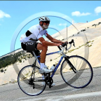
You first climb gently climb from La Croisette to the Col des Pitons. Then follows a long downhill (with a few intermediate short climbs) to the Rhone river near the village Chancy. A great exercise if you go full-out on the uphill and flat parts, and recover on the downhills. Enjoy!!
See other downhills at downhills by Gonvil
(PS: 'likes' and 'comments' on the video are much appreciated. Please send comments on the functioning of the app to the User Support)
For more than 1000 scenic videos all over Europe, see my other videos by Gonvil and Playlists by Gonvil.
 Strava segments
Portions of this video are actual Strava segments


| Pos. | Username | Chrono | Date |
|---|---|---|---|
| 1 | 00:35:31 | 1/29/2022 | |
| 2 | 00:37:15 | 3/4/2022 | |
| 3 | 00:37:37 | 3/2/2022 | |
| 4 | 00:37:50 | 2/23/2022 | |
| 5 | 00:39:21 | 2/22/2022 |

You can try our application fully and for free and challenge community members.
iOS Android No access to Google Play? Download the APK nowGet all features and videos for only $11.99/month
Subscribe nowYou will probably like...

29.966 mi | 01:58:15

24.822 mi | 02:10:23

15.59 mi | 01:12:32

12.442 mi | 00:45:22

11.866 mi | 00:50:23

12.187 mi | 01:07:48

25.786 mi | 01:36:22

16.896 mi | 00:56:39

23.649 mi | 01:22:56

16.861 mi | 01:08:52

11.534 mi | 00:42:52

12.388 mi | 00:50:31


 French
 German
 United States
 Chinese
 Spanish
 Italian
 Dutch
Dutch