
7202 Mt Hamilton Rd, Mt Hamilton, CA 95140, USA
16049-16059 Alum Rock Ave, San Jose, CA 95127, USA
This video was recorded using a stabilization device that keeps the camera level with the horizon (Noir Matter Quark)
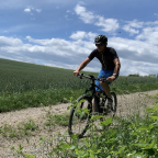
This ride goes down from the Lick observatory, on Mount Hamilton rd, to Alum Rock rd at the bottom.
Note: There is a 2 mins stop in the video. A bee got in my jersey and was stinging me in my chest.
Go to this playlist if you like riding downhills
I hope that you will also enjoy some of my other videos and my playlists! Or just pick a riding location on the map!
Ride on!
 Strava segments
Portions of this video are actual Strava segments


| Pos. | Username | Chrono | Date |
|---|---|---|---|
| 1 | 00:23:07 | 1/26/2021 | |
| 2 | 00:30:45 | 1/14/2022 | |
| 3 | 00:31:41 | 5/16/2023 | |
| 4 | 00:32:43 | 5/9/2020 | |
| 5 | 00:32:46 | 3/30/2020 |

You can try our application fully and for free and challenge community members.
iOS Android No access to Google Play? Download the APK nowGet all features and videos for only $11.99/month
Subscribe nowYou will probably like...

15.59 mi | 01:12:32

25.786 mi | 01:36:22

14.175 mi | 01:03:03

15.58 mi | 01:02:18

23.649 mi | 01:22:56

17.566 mi | 00:44:31

14.298 mi | 00:53:07

15.128 mi | 00:55:57

10.433 mi | 00:44:11

9.218 mi | 00:35:00

11.475 mi | 00:58:04

15.76 mi | 01:15:25


 French
 German
 United States
 Chinese
 Spanish
 Italian
 Dutch
Dutch