
8500 W Butte Rd, Live Oak, CA 95953, USA
2588 Acacia Ave, Sutter, CA 95982, USA
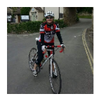
The Sutter Buttes lie 50 miles north of Sacramento, California, and are sometimes called the world’s smallest mountain range. However, the buttes are technically not mountains, but rather hills topped by eroded domes formed by volcanic activity 1.6 million years ago. Sutter Buttes’ highest point is 2,122 feet high, a dramatic contrast to the flat agricultural lands that stretch out past the buttes for miles. The Buttes, and the neighboring town, are named after Captain John Sutter, who received a large land grant from the Mexican government in the 19th century. Most of the land is private property used by ranchers and farmers, although in 2003 the state of California acquired 1,785 acres of the Buttes, including a section called Peace Valley. On April 8, 2005, the State Park and Recreation Commission classified the State Parks Sutter Buttes Property as a State Park.
Ride my other videos around the Sutter Buttes
Enjoy my other videos and playlists!
 Strava segments
Portions of this video are actual Strava segments


| Pos. | Username | Chrono | Date |
|---|---|---|---|
| 1 | 00:49:52 | 2/13/2022 | |
| 2 | 00:51:12 | 5/9/2024 | |
| 3 | 00:52:32 | 3/1/2021 | |
| 4 | 00:55:36 | 12/29/2021 | |
| 5 | 00:56:51 | 1/4/2024 |

You can try our application fully and for free and challenge community members.
iOS Android No access to Google Play? Download the APK nowGet all features and videos for only $11.99/month
Subscribe nowYou will probably like...

38.263 mi | 02:08:38

36.312 mi | 02:24:03

22.915 mi | 02:30:50

22.855 mi | 01:40:59

13.514 mi | 00:56:09

19.092 mi | 01:10:48

16.323 mi | 00:55:27

15.76 mi | 01:15:25

13.244 mi | 00:49:02
![[GRAVEL] Along the river to the forest (Poland)🚵🏘️🏙️🌲](https://dtn44hfc1xtr4.cloudfront.net/p/x/pxrab6_320x240.jpg?Expires=1752206961&Signature=NfNFX6O4zePPucZNaguXJRxW3G3xFbUwPOqbyEouQMRutquQqysxbDfR53aiimi1m5V7XbTa8C5o~nb-AVqKS6ahKD02r6AMhU6GCvVIkBnSPAJoTFKLRixUC8RMYtH3SV2R~IQegM92cM25s~IF5kPAzNGNNuOSta4oh~G-JAei6Mh~ED~K0zKSdWNILpVrPEkQAtrf6uNVZ~IKn8l7KNxCoxvZnOVhHUD0lQgSJ7S9sVgBQ7EiSgbtuXMmMuQgQWESxZVniDSkhmi4s8crHjmGzmRapUGXvctPSiNdEGM7FSAa88Ocy1n1j~T2Po9hS5qbosTN3Xd~Oz2DgUXIAA__&Key-Pair-Id=APKAIAOH4YUSYMI7SPBA)
14.473 mi | 00:56:48

15.051 mi | 01:15:37

17.953 mi | 01:19:37


 French
 German
 United States
 Chinese
 Spanish
 Italian
 Dutch
Dutch